Landscape Rendering Software Compared for Real Workflows
Compare landscape rendering software by criteria, workflows, pricing and speed. Find the best fit for architects, landscapers and real estate teams.
A client call lands late in the afternoon. The planting plan is clear to you, the grading logic makes sense, and the hardscape is documented. The stakeholder sees lines, symbols, and a legend. They still can't tell whether the site will feel open in summer, muted in winter, or crowded once the trees mature.
That gap is where rendering software earns its place. A useful visual doesn't replace a measured plan or construction documentation, but it can help architects, designers, developers, and real estate teams make decisions before a full 3D scene is built. The practical question isn't which tool produces the prettiest image. It's which workflow gets from an existing plan, sketch, PDF, or site photo to a credible visual without creating more coordination work than it removes.
Table of Contents
- Introduction Why Landscape Visuals Make or Break Approvals
- What Landscape Rendering Software Actually Does Today
- How to Evaluate Landscape Rendering Software Without Guesswork
- Detailed Comparison of Common Tools and Workflows
- Use Cases for Architects Landscapers and Real Estate Teams
- Pricing Turnaround and Practical Recommendations
- Frequently Asked Questions About Landscape Rendering Software
Introduction Why Landscape Visuals Make or Break Approvals
Projects are judged through experience. People want to understand the arrival sequence, the relationship between planting and paving, the height of a screen, and the atmosphere of an outdoor room. A two-dimensional plan can communicate those facts to a trained professional, but clients and approval groups often need a visual reference before they can respond usefully.
That matters during early reviews. If a stakeholder misunderstands the tree canopy, assumes a retaining wall is taller than intended, or reads a planting bed as empty space, the next meeting may focus on correcting the image rather than evaluating the design. A render gives the conversation a shared object.
The strongest workflow starts with the material you already have. That might be a CAD export, a PDF plan, a hand-marked sketch, or a photograph of the existing property. The output may be an isometric site graphic for a concept review, a perspective view for a proposal, or a small set of seasonal options for a garden presentation. The right format depends on the decision the image needs to support.
A useful reference for early concept work is this guide to landscape design concepts, particularly when the design is still being tested rather than documented for construction.
Practical rule: Use the fastest workflow that preserves the design decisions your client actually needs to review.
This comparison focuses on that point. It looks at CAD and real-time workflows, dedicated plug-ins, photo-based AI tools, and plan-aware generation. It also separates rapid visual exploration from the tasks that still require controlled modeling, accurate plant schedules, grading information, and construction-ready documentation.
The hard trade-offs are integration friction, vegetation behavior, seasonal consistency, turnaround, team adoption, and predictable cost per image. Rendering software can be valuable without solving every one of those problems, but you need to know which limitation you're accepting before a deadline exposes it.
What Landscape Rendering Software Actually Does Today
The phrase landscape rendering software covers several different jobs, and confusing them creates poor buying decisions.
First, a tool may turn a 2D plan into a spatial representation. It can help communicate terrain zones, paths, patios, walls, planting masses, pools, and outdoor rooms. Second, it may apply materials, light, atmosphere, people, and vegetation to create a more realistic view. Third, it may generate alternate directions from the same base, such as a different planting mood, material palette, or seasonal condition.
Traditional CAD and BIM tools remain strong when geometry, dimensions, layers, and documentation matter. Real-time engines are useful when a team needs to inspect a modeled environment, change materials, or walk through a site while design decisions are still moving. AI workflows can shorten the distance between a reference image and a presentable concept, especially when the task is visual exploration rather than exact modeling.
The limitation is important. Dense vegetation is difficult because plants overlap, vary in scale, obscure surfaces, and need to remain believable from different distances. Independent technical research on interactive vegetation rendering demonstrates that dense plant geometry can be rendered at 60 FPS, with measured ranges of 70 to 150 FPS for one tree and 140 to 260 FPS using a simpler shader path, depending on pixel coverage and hardware, as documented in this technical research on interactive vegetation rendering. Those figures describe a rendering-performance problem, not a guarantee that a design tool will produce botanically accurate planting.
Why firms still rely on 2D workflows
Adoption remains uneven because the cost of moving from 2D production to full 3D isn't limited to licensing. Teams also need clean models, asset libraries, capable hardware, training, naming conventions, and someone responsible for maintaining the scene.
The 2024 ASLA Digital Technology Software Survey found that AutoCAD was rated “extremely important” by 73% of respondents, while Lumion received that rating from 22%, and Enscape from 11%. The same survey reported that 46% of firms don't use Lumion and 67% don't use Enscape, evidence that 3D visualization tools remain far from universal in professional practice. The survey also referenced earlier work showing only 30% of landscape architecture professionals used 3D software often or very often in daily work. See the 2024 ASLA Digital Technology Software Survey for the reported adoption context.
That gap explains the appeal of low-setup workflows. A team may want a client-ready image without rebuilding its entire CAD process. Tools such as AI rendering for design workflows fit into that space when used as visual support, not as a replacement for measured documentation.
How to Evaluate Landscape Rendering Software Without Guesswork
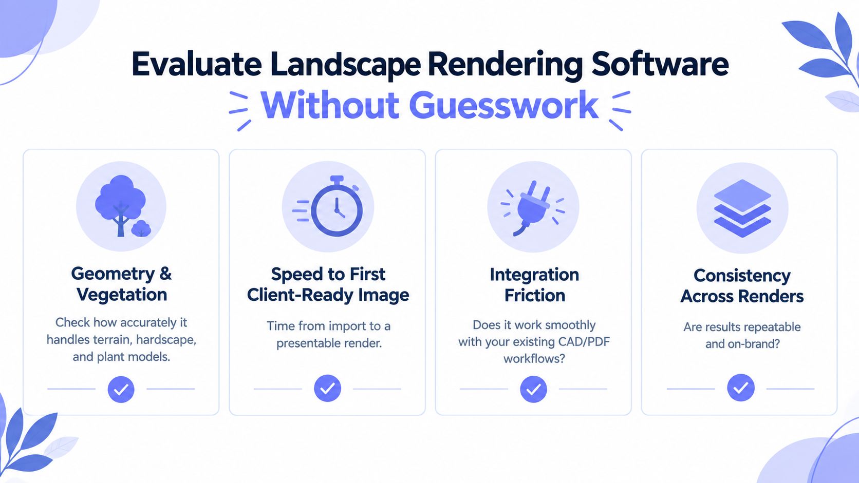
The cleanest test uses a real project file, not a sample image supplied by the vendor. Choose a plan with the problems your team faces regularly: irregular site boundaries, a mix of hardscape and planting, a building edge, at least one grade or enclosure condition, and enough context to judge scale.
Start by checking geometry fidelity. Does the tool preserve the relationship between building, path, wall, patio, and planting zone? If it starts from a photo, does it respect the existing site rather than inventing a new one? If it starts from a plan, can you recognize the original layout without correcting every major element?
Vegetation deserves its own test. Look at foreground plants, mid-ground shrubs, and distant trees separately. AI-generated visuals can communicate density and mood quickly, but they may weaken when the image requires a specific species, a close-range canopy, or a precise layered planting composition. Seasonal storytelling raises another test: can the same design be shown in summer foliage, autumn change, winter dormancy, and spring bloom without shifting the architecture, camera, or major layout?
The evaluation checklist
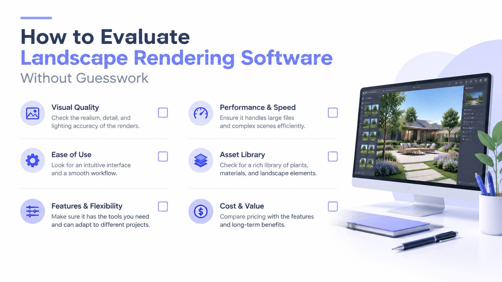
Use the same source file for every shortlisted workflow. Record the time from import to the first acceptable image, then record how much correction each variation needs.
- Speed to first client-ready image: Measure the complete path from upload or import to a presentable frame, not just the final processing time.
- Integration friction: Test JPG, PNG, HEIC, WebP, PDF exports, and whatever your team hands between software packages. File support matters only if the handoff keeps the project legible.
- Consistency across variations: Change one thing at a time, such as planting mood or lighting. If walls, openings, and proportions drift, the workflow may be unsuitable for approval graphics.
- Output and rights: Confirm export resolution, permitted commercial use, watermark behavior, and whether generated images can enter client proposals.
- Learning curve: Ask a designer who didn't configure the test to repeat it. A workflow that only one visualization specialist can operate creates a scheduling dependency.
- Cost per usable image: Count the images that survive review, not the total number generated. A cheap render that needs extensive repainting isn't cheap in practice.
| Role | Highest priority | Acceptable compromise |
|---|---|---|
| Landscape architect | Geometry and documentation handoff | Slower final rendering |
| Visualization lead | Consistency and output control | More setup for complex scenes |
| Garden designer | Planting mood and seasonal variation | Manual refinement of species |
| Real estate marketer | Turnaround and predictable cost | Less technical planting detail |
| Small studio | Ease of adoption and file flexibility | Fewer advanced controls |
Test the handoff, not just the picture. A convincing image that can't be traced back to the approved plan creates a coordination problem later.
You should also test failure conditions. Crop the plan, include a low-resolution sketch, or use a site photo with shadows and obstructions. The goal isn't to make the tool fail unfairly. It's to learn where your team will need a second workflow, manual cleanup, or a traditional model.
Detailed Comparison of Common Tools and Workflows
Four workflow categories cover most practical choices.
Traditional CAD or BIM plus a real-time engine gives the team the strongest relationship between model and view. Changes to the source model can flow into the visualization, and the designer can inspect terrain, hardscape, lighting, and planting in context. The price is setup. Vegetation libraries, materials, scene organization, hardware, and operator skill all affect the result. This approach works best when the project will remain in 3D through detailed coordination or immersive review.
Dedicated plug-ins sit closer to the design application and can reduce file exchange. They suit teams that already model in compatible software and want rapid viewport feedback. Their performance depends on the quality of the host model, available assets, and the team's willingness to maintain a real-time scene. They aren't automatically easier because they're integrated.
AI photo-based rendering and staging tools start with an existing exterior image and produce visual directions quickly. They work well for mood, style, broad planting character, and sales conversations. They work less reliably when the brief requires exact species placement, detailed mid-ground vegetation, construction dimensions, or a stable camera across many precise revisions.
Vizcraft offers ISO Mapper for floor-plan isometric views, Interior Design for boards from floor plans, and Exterior Studio for exterior concepts from photos. These images support design discussion; verify dimensions, openings, scale, and construction intent against the source drawings.
| Workflow Category | Setup and Learning Curve | Vegetation and Seasonal Handling | Speed and Iteration | Best Fit |
|---|---|---|---|---|
| CAD or BIM plus real-time engine | High setup, stronger control after modeling | Strong when assets and scenes are built well, but time-intensive | Fast after setup, slower at project start | Ongoing 3D coordination and immersive reviews |
| Dedicated landscape plug-in | Moderate, especially with a compatible host | Useful libraries and direct context, quality varies by asset system | Responsive inside the host application | Firms already committed to a supported CAD or BIM workflow |
| AI photo-based rendering | Low setup, little technical training | Good for broad mood and seasonal direction, weaker for exact planting detail | Very fast for concept variations | Client exploration, proposals, and existing-site visuals |
| Plan-aware AI workflow | Low to moderate, depending on source plan quality | Useful for planting structure and concept views, requires review for dense vegetation | Fast from source material, with quick variation cycles | Early design reviews, isometric communication, and lightweight presentations |
The comparison is less about a universal winner than about where the workflow begins. A modeled project favors tools that preserve geometry and provide live feedback. A photographed property favors image-based generation. A PDF or sketch favors a plan-aware process that can establish spatial relationships without requiring a full 3D rebuild.
Benchmarking also needs discipline. SPECviewperf measures graphics performance from real application workloads, while benchmark guidance commonly compares fixed scenes by completion time or throughput so results remain repeatable across machines, as described in this SPECviewperf workload guidance. That kind of benchmark can help with hardware decisions, but it doesn't measure whether a team can produce a convincing, consistent planting visual from its own files. Test both.
For a broader feature and workflow comparison, use this rendering software comparison, then validate the shortlist against one real site plan and one real seasonal brief.
Use Cases for Architects Landscapers and Real Estate Teams
The right choice changes with the meeting you need to support. An architect preparing a concept review has a different tolerance for approximation than a contractor documenting a wall or a marketing team preparing an exterior proposal.

Architects and visualization teams
An architect may receive a floor plan, site plan, or PDF markup and need an isometric or perspective visual for an early client review. The useful input is the cleanest available plan, plus a short instruction about camera direction, materials, planting mass, and the level of surrounding context.
The expected output is a small set of concept images, not a construction package. An isometric site view can clarify circulation and program. A perspective can establish the relationship between building edge, terrace, planting, and outdoor rooms. A traditional CAD or BIM model should remain the source of truth if the design proceeds into coordination.
For projects that begin with floor plans, ISO Mapper is the relevant starting point. It can be used to turn 2D source material into a spatial visual before the team commits time to a fully detailed scene.
Landscapers and garden designers
A garden designer usually needs to communicate atmosphere and planting evolution. The same concept may need to appear as summer foliage, autumn change, winter dormancy, and spring bloom. That sequence helps a client understand that a garden is not a single static image.
AI is useful for the first conversation when the decision concerns mood, density, structure, or material direction. It is less dependable for a close-up planting plan where every species, spacing, mature form, and understory relationship must be correct. Dense mid-ground vegetation and close-range canopies deserve manual review, especially when the client might treat the render as a planting specification.
A practical handoff is to use the visual to approve the direction, then refine species, quantities, grading, irrigation, and construction details in the appropriate design documents. The AI landscape design tool workflow is relevant for generating concept options from outdoor references, sketches, or plans.
Real estate teams and developers
A real estate marketer often needs an image before a detailed model exists. The input may be a site photograph, a preliminary plan, or an exterior elevation with a description of the proposed public realm. The output needs to be clear enough for a proposal, pitch deck, or development conversation.
The trade-off is intentional abstraction. A marketing visual can show the likely character of a courtyard, entry garden, pool terrace, or streetscape without claiming that every plant and surface has been documented. The team should label the image as a concept when design details remain unresolved.
For this audience, turnaround and consistency usually matter more than botanical specificity. A repeatable camera, stable building geometry, and a coherent material mood are more valuable than a large asset library if the images need to support several project options in a short review cycle.
Pricing Turnaround and Practical Recommendations
Cost comparisons become useful only when they reflect the way a team produces images. A monthly plan with unused capacity may cost more than a one-time credit pack for an occasional designer. A low per-image rate may also lose its advantage if each render requires extensive cleanup.
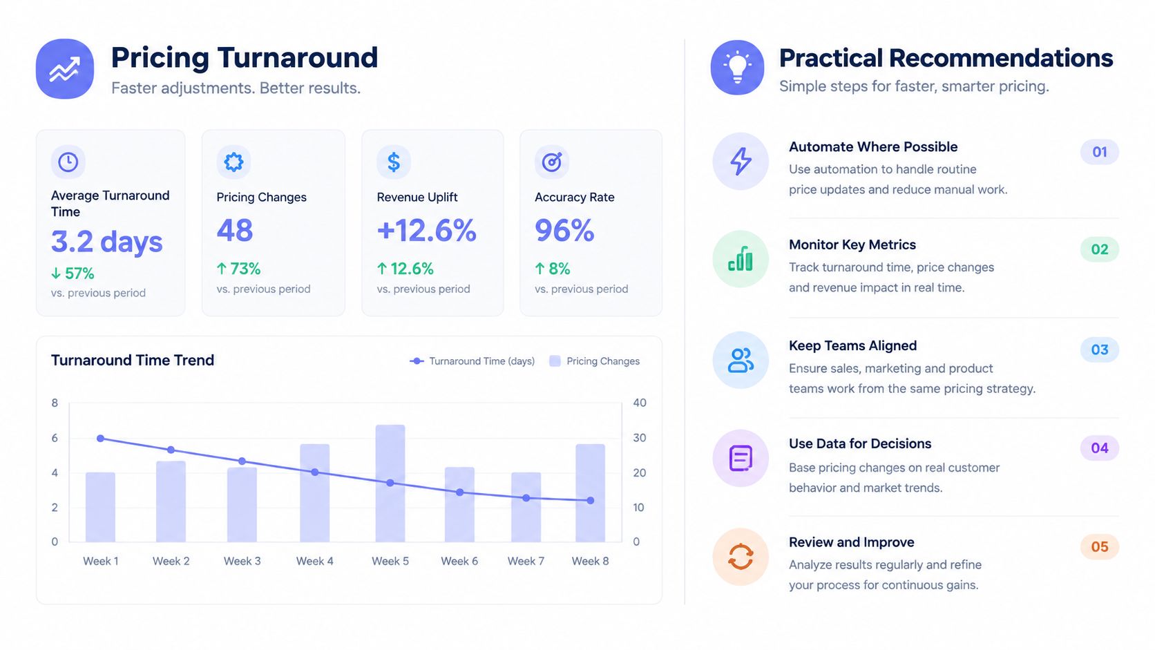
Vizcraft's published model uses credits rather than a separate charge for every type of scene. Starter costs $19 per month for 25 renders, Pro costs $49 for 100, and Studio costs $99 for 250. One-time packs start at $7, and the stated per-render range is $0.40 to $0.76, depending on the plan or pack. Those figures are product pricing, so confirm the current terms on the Vizcraft pricing page.
Generation time depends on the source and model, while a complete upload, review, variation, and selection loop can take minutes. That distinction matters. Processing time isn't the same as decision time, and teams should budget for checking geometry, vegetation, lighting, and client-specific revisions.
| Workflow need | Practical cost logic | Turnaround trade-off |
|---|---|---|
| Occasional concept review | One-time credits avoid paying for unused monthly capacity | Fast generation, manual review still required |
| Regular solo production | A monthly tier can reduce the effective per-render cost | Useful for repeated client iterations |
| High-volume studio work | Compare included renders with actual usable output | More capacity helps, but consistency testing matters |
| Construction documentation | Keep traditional CAD or BIM production in the loop | Slower, controlled, and dimensionally accountable |
A sensible recommendation is to use AI for directional exploration, seasonal storytelling, and early approvals, then move approved decisions into the system responsible for accurate plans and specifications. Use a real-time engine when the project benefits from live model changes, walkthroughs, or detailed scene control. Use photo-based generation when the existing site image is the strongest source of truth.
If your main problem is getting from a plan to a useful visual without rebuilding a scene, start with ISO Mapper. You can try it with 2 free credits and no credit card required, then compare the result against your current workflow before committing to a plan. For a broader discussion of pricing models, see this AI rendering tool pricing comparison.
Frequently Asked Questions
How does landscape rendering differ from interior rendering?
Scenes contain open sky, changing light, terrain, hardscape, and vegetation at several distances. Plants also change by season and can obscure the geometry they're meant to frame. Interior rendering usually offers tighter control over walls, furniture, finishes, and lighting, while rendering requires more attention to context, scale, canopy behavior, and planting density.
Can AI handle detailed planting plans accurately?
AI can communicate planting mood, massing, and seasonal character quickly, but it shouldn't be treated as a precise planting schedule. Dense mid-ground vegetation, close canopies, exact species, spacing, and mature growth relationships may need manual correction. Use the render to approve direction, then verify planting, grading, irrigation, and quantities in controlled design documents.
What file types can you start from?
A practical workflow may begin with a JPG, PNG, HEIC, or WebP image, a PDF export, a hand-drawn sketch, or a site photograph. Clean contrast and legible linework help plan-based tools preserve spatial relationships. Always test the actual file your team uses, because a workflow that performs well on a clean sample may behave differently with scans, annotations, or incomplete plans.
Should you buy a one-time pack or monthly plan?
Choose a one-time pack when visuals are occasional or tied to a single proposal. Choose a monthly plan when you regularly produce variations, seasonal views, or client-review images. Compare expected usable renders with the included capacity, then account for review and refinement time. You can test the workflow with 2 free credits and no card required before deciding.
Vizcraft offers ISO Mapper for floor-plan isometric views, Interior Design for boards from floor plans, and Exterior Studio for exterior concepts from photos. These images support design discussion; verify dimensions, openings, scale, and construction intent against the source drawings.